The United States National Weather Service's Storm Prediction Center has issued a severe storm risk alert for tonight. Once again, atmospheric instability will create a scenario of intense rain and winds in some states. Undoubtedly, another episode of a spring that continues to be wet and windy in this part of North America.
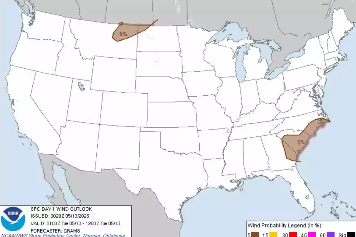
This time, the affected areas range from the Savannah Valley to the coastal Carolinas, as well as parts of Montana and North Dakota. According to the official report, isolated but potentially severe storms are expected to develop in these two regions. The risk of tornadoes, although low, is present in parts of Georgia, South Carolina, and North Carolina.

They highlight the probability of tornado formation
It is there where a zone with a 2% probability of tornado formation has been outlined. Conditions in these areas could generate short tornadoes or intense wind gusts known as wet microbursts. The active convective system in eastern Georgia and northern South Carolina continues to move northeast.
Although atmospheric instability is weak in the coastal region, a favorable environment for localized severe phenomena is kept. Likewise, these threats are expected to concentrate particularly between southeastern South Carolina and southern North Carolina until the early morning hours. Meanwhile, northeastern Montana and northwestern North Dakota are also under watch.

Intense wind gusts
This time, due to the presence of a cold front of Pacific origin. Despite the limited energy for storms, temperature differences will generate wind gusts between 55 and 70 mph (88.5 and 112.7 km/h). This phenomenon could be recorded during the course of the night in those areas.
In addition to the risk of tornadoes, areas with the probability of severe winds have been outlined in both the Carolinas and Montana and North Dakota. Emphasizing the potential for localized adverse conditions. Thus, the population in the affected areas should stay alert to local weather advisories and take precautions.

