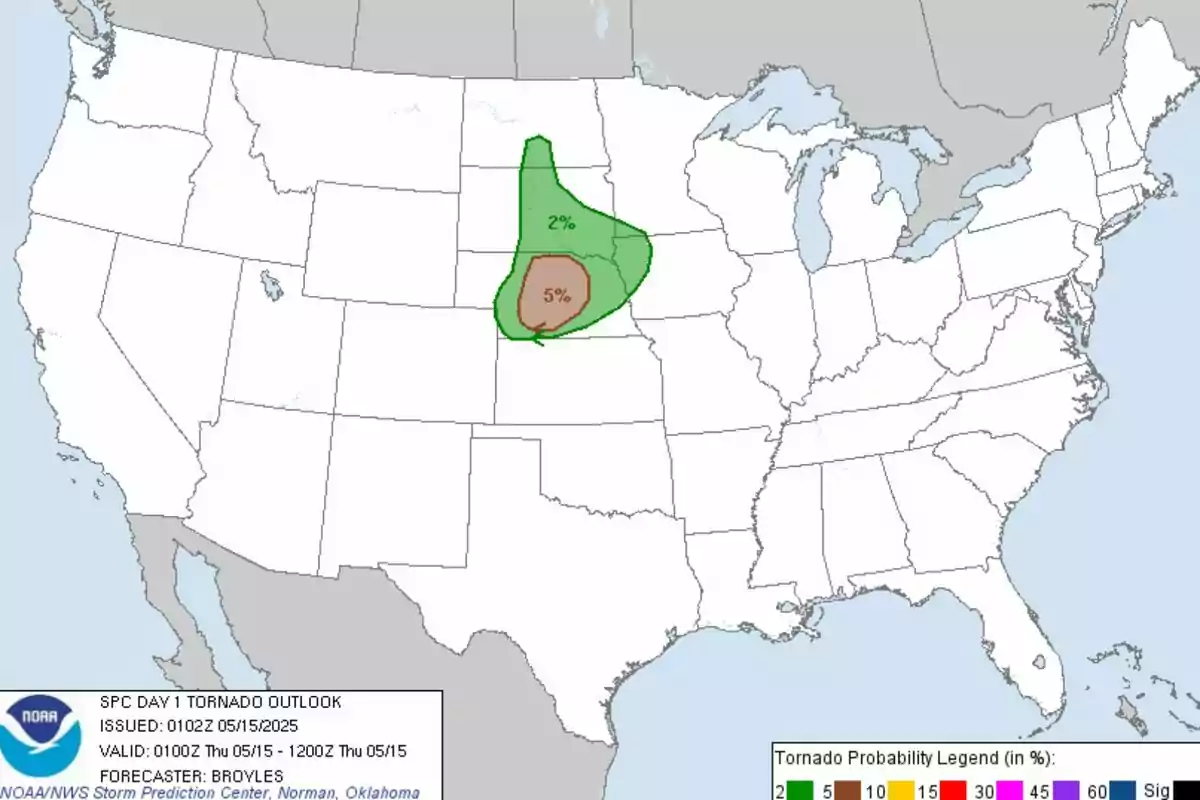
The National Weather Service has issued a severe weather warning for this Thursday in several regions of central and northern United States. The formation of strong to severe storms is expected to follow the trail of previous days. This time of year is sensitive to these types of phenomena that require special alert for the public.
Tornadoes will affect a dozen states. Specifically, the map has marked warnings in Nebraska, Kansas, Missouri, Iowa, South Dakota, Minnesota, Illinois, Indiana, Arkansas, Oklahoma, Colorado, and Wyoming. Current atmospheric conditions suggest the possibility of large hail, destructive wind gusts, and some tornadoes.

All of this is creating a favorable atmospheric pattern for convection. This situation is reinforced by a cold front moving east-southeast, along with the presence of a low pressure centered between Kansas and southern Nebraska. These conditions are generating bands of storms, where surface temperatures and moisture content are particularly high.
Important instability conditions
In Nebraska, instability conditions are recorded with temperatures around 80.6° F and energy levels available for storms between 2000 and 3000 J/kg. Several supercells have already developed in this region, some of which could generate tornadoes in the coming hours. The Doppler radar in North Platte has detected an increased probability of rotation in the storms.
Additionally, these storms are expected to evolve into linear structures, with a higher risk of severe winds and hail over 1.97 in. (five cm) in diameter. Short-term weather models indicate the development of a bow echo. This is a type of storm system associated with very intense winds, which could move toward the northeast.

Wind gusts and hail
Meanwhile, a lower risk area extends from the lower Ohio Valley to the Carolinas. It is there where isolated storms with wind gusts and hail could develop. Although the risk there is more marginal, active monitoring is kept for possible severe local developments.
For all these reasons, experts recommend that residents stay informed and prepared for possible severe storm alerts. The weather outlook could change rapidly in the coming hours. Thus, the saying "better safe than sorry" is fulfilled.

