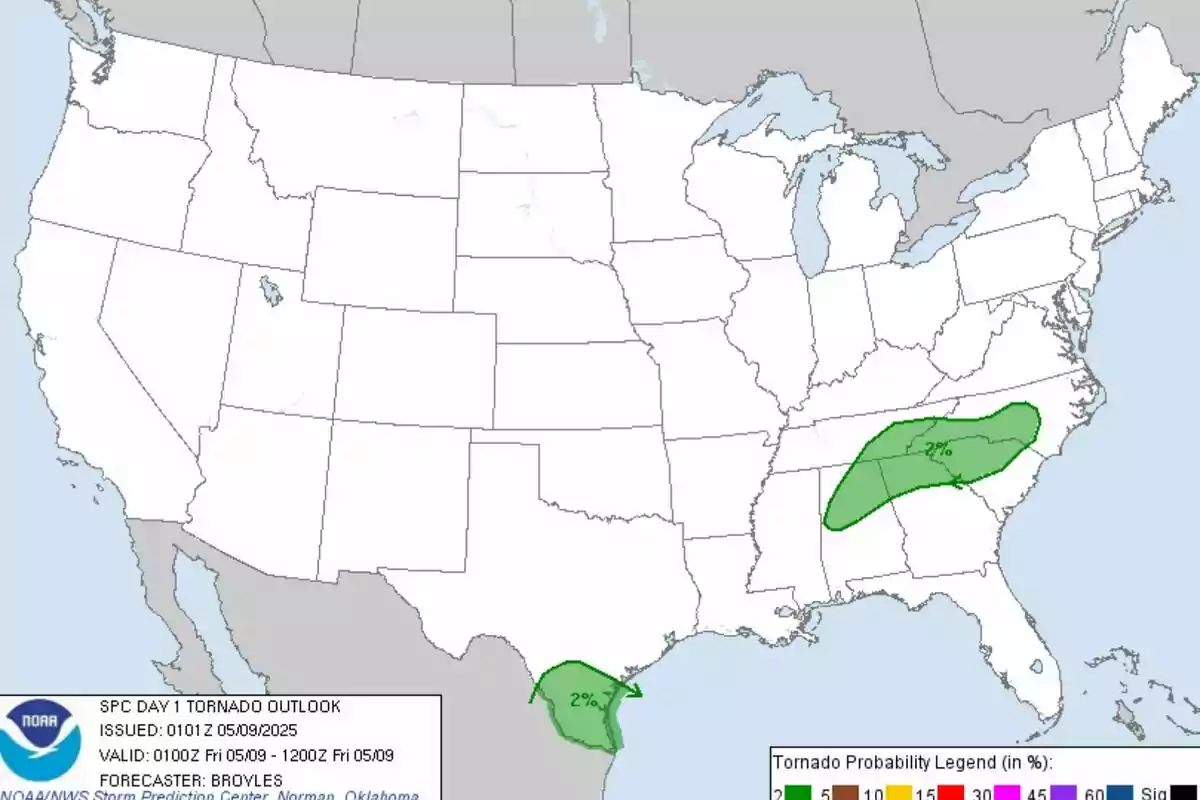
The National Weather Service's Storm Prediction Center has issued a severe storm risk alert that could include tornadoes. Also, wind gusts and large hail for this Thursday night in several regions of the southern and southeastern United States. The forecast map shows areas marked with a slight risk, indicating the possibility of scattered severe storms.
However, the most affected areas include parts of Texas, North Carolina, Tennessee, Alabama, Georgia, and South Carolina. In southern Texas, strong storms are developing driven by a low-pressure system in the Rio Grande Valley. The formation of supercells capable of producing hail over 2 in. (5 cm) in diameter is anticipated.

The atmosphere in this region is characterized by high humidity with dew points in the 75 °F (24 °C) and moderate to strong instability. This contributes to an environment conducive to severe phenomena. Meanwhile, in eastern states like Tennessee, North Carolina, Alabama, Georgia, and South Carolina, a trough is generating favorable conditions for storm development.
Experts predict the arrival of severe wind gusts and hail
Severe wind gusts and hail are being observed, with a risk of isolated tornadoes. The current storms are concentrated along a front and are being fueled by moderate to strong shear in the mid-levels of the atmosphere. Meteorological authorities recommend that residents of affected areas keep informed through official sources.
As well as having multiple means of receiving alerts and having an emergency plan ready. While the intensity of the storms is expected to decrease during the early morning, additional severe events are not ruled out. The SPC will continue to monitor the evolution of conditions during the night, issuing updates as necessary.

A turbulent week
No one quite gets used to this type of extreme weather phenomena. Their risk and danger keep citizens living in the affected states on constant alert. Even so, it must be taken into account that this is not the first time it has happened and that these states experience marked and intense climatic instability.

